We recently learned that the Prince William County Department of Transportation will soon conduct a Hoadly Road Planning Study to identify priorities for funding and then building segments of a continuous shared-use path (i.e., a 10-foot wide asphalt sidepath) along Hoadly Road, between the Prince William Parkway (Route 294) and Dumfries Road (Route 234). Hoadly Road currently lacks any sidepath, except along the 0.4-mile segment between Dale Boulevard and Spriggs Road.
Active Prince William strongly supports establishing a continuous sidepath along at least one side of Hoadly Road, especially since such shared-use pedestrian facilities would link Prince William County’s two major sidepaths–along Routes 234 and 294.
However, the Mobility Chapter of the current Prince William County Comprehensive Plan (Pathways to 2040), which the Board of County Supervisors adopted in December 2022, is deficient in not also calling for on-road bicycle lanes along Hoadly Road (see page 73 here).
There is no inherent reason why highway corridors should include only one type of bicycle facility–e.g., only a sidepath–especially since conventional bike lanes can be retrofitted on multi-lane roadways much more quickly and inexpensively and since having both on-road and off-road bicycle facilities could best serve our highly diverse population of bicycle riders. In addition, bike lanes are more readily and promptly cleared of snow and ice after winter storms.
Furthermore, bike-lane retrofits have the added benefits of reducing motorist speeding (by reducing travel lane widths) and of increasing the safety and comfort of people traveling on the sidewalks or sidepaths (by increasing the noise and wind buffer from vehicular traffic).
Hoadly Road currently has an excessively high design speed, a posted speed limit of 50 MPH, and poor pedestrian infrastructure. Consequently, according to Virginia’s publicly searchable traffic crash database, over the past decade (2014-2023 calendar years), Hoadly Road was the site of 403 traffic crashes, 310 crash-associated injuries, and 4 traffic fatalities. Retrofitted bike lanes on Hoadly Road would help alleviate those unsafe conditions for all modes of travel.
When widened some decades ago, Hoadly Road gained continuous wide paved shoulders that were well suited for bicycling, and at least some of those shoulder segments were subsequently marked as bike lanes.
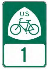
US Bicycle Route 1 (USBR 1) is a Maine-to-Florida bicycling route–primarily intended for experienced bicycle travelers–that has existed for decades. USBR1 in Virginia, upon VDOT’s written application, was designated by the American Association of State Highway and Transportation Officials (AASHTO) back in 1982, more than 40 years ago. Although USBR1 through Prince William County was originally aligned with Minnieville Road, between Old Bridge Road and Dumfries Road, VDOT and Prince William County largely failed to include appropriate bicycle facilities along much of Minnieville Road during the ensuing decades. as segments of Minnieville Road were sequentially widened to accommodate increased development and traffic.
More than a decade ago, VDOT commissioned a study by a transportation consulting firm to re-evaluate the routing of US Bicycle Route 1 through Northern Virginia, including Prince William County. As a result of that study, USBR1 was officially realigned to follow a segment of the Prince William Parkway and all of Hoadly Road, to avoid the segment of Minnieville Road north of Cardinal Drive that still lacks bicycle facilities.
As noted on page 11 of that USBR1 realignment study report (emphasis added below):
Although less direct than the other alternatives, the recommended alternative (via Minnieville Road, Prince William Parkway, and Hoadly Road) offers a higher average BLOS [Bicycle Level of Service] (B), primarily the result of lower ADT [average daily traffic] and wider shoulders. The route segment along Minnieville Road and Prince William Parkway has high ADT (up to 45,000 vehicles per day), but also provides shared use paths or wide shoulders for much of the duration. Meanwhile, Hoadly Road has approximately 13,000 to 23,000 vehicles per day and provides 8‐foot shoulders along many segments.
Google Street View reveals that various segments of Hoadly Road currently do have marked bike lanes, but these are discontinuous and often inappropriately situated on the right side of long right-turn-only lanes, such as here, here, here, and here. Glaring deficiencies in Hoadly Road’s “bike lanes” were noted by a resident back in 2010 [mislabeled a “bike path” in that blog post].
Since the entirely of Hoadly Road has been the designated alignment of US Bicycle Route 1 for nearly the past decade, Active Prince William asks that VDOT and Prince William County proactively collaborate to retrofit continuous and well-designed bike lanes–and, ideally, buffered or separated bike lanes–along all of Hoadly Road at the earliest possible opportunity.
We also recommend adding the planned Hoadly Road sidepath as a designated segment of the National Capital Trail Network (NCTN) when the National Capital Region Transportation Planning Board again updates its NCTN map in the coming year.
