On May 8, 2025, Active Prince William’s co-chair, Allen Muchnick, delivered the following statement at the Commonwealth Transportation Board’s spring 2025 Six-Year Improvement Program public hearing for VDOT’s Northern Virginia District:
Commonwealth Transportation Board’s Pre-Allocation Public Hearing for the Northern Virginia District, May 8, 2025, Statement of Allen Muchnick, Co-Chair, Active Prince William
Good evening. I’m Allen Muchnick, co-chair of Active Prince William. We advocate for improved active mobility and public transportation throughout greater Prince William, for healthy, livable, equitable, and sustainable communities.
Last December, VDOT’s NoVA District office released an analysis of the roughly 5,000 miles of locally planned but currently unfunded active transportation facilities throughout the District. That non-exhaustive analysis estimated the present-dollar (2022) cost to create those already planned active mobility facilities to total roughly 14 billion dollars.
At the present rate at which standalone active mobility projects are funded, it would take hundreds of years to complete those already planned active mobility facilities. The NoVA region needs a study to figure out how to more effectively fund active mobility infrastructure.
Since 2010, VDOT’s roadway reconfiguration program has wisely reallocated excess travel lane space in Fairfax County, to cost-effectively retrofit bike lanes and pedestrian safety improvements on many dozens of roadways during scheduled resurfacing, while also reducing speeding. However, Prince William and Loudoun Counties have largely been excluded from this program, because their local transportation planners were not notified early enough of the candidate road resurfacing projects. We urge VDOT’s maintenance division to extend this earlier notification of repaving candidates to all Virginia counties.
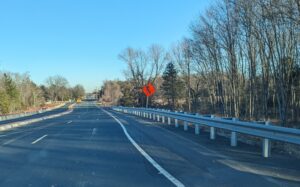
The alignment of US Bicycle Route 1 through Prince William County is a prime example where retrofitted bike lanes or paved shoulders are desperately needed. Although AASHTO and VDOT established this route more than 40 years ago and a VDOT consultant re-evaluated the route’s alignment through NoVA more than a decade ago, the bicycling conditions on several Prince William route segments just get worse. The County’s online Bicycle Skill Level Map labels Old Bridge Road, part of Minnieville Rd, Aden Rd, and Fleetwood Dr—all lacking bicycle facilities and posted at 45-MPH–as “Roads to Avoid” and tags Hoadly Rd and Tanyard Hill Rd as “Low Comfort”. VDOT’s 2015 Bicycle Level of Service Map for the NoVA District rated those segments similarly. It’s long past time for VDOT and the County to fix those embarrassing and potentially deadly deficiencies.
Despite the hundreds of miles of VDOT-owned shared-use paths and sidewalks throughout the NoVA District, VDOT still performs little maintenance and repair of such assets, except in response to reported complaints. After construction, the pavement is left to deteriorate for decades and is fixed only after repeated complaints. VDOT still has no annual budget or established policies and procedures to adequately and proactively assess and maintain its active mobility assets. As a first step, the Virginia Transportation Research Council might be asked to study how to best accomplish this perpetual maintenance.
Thank you for this opportunity to comment.
###