Advancing active mobility in greater Prince William, Virginia

Category: Transit (Page 2 of 4)

2018 Manassas Community Conversations and Comprehensive Plan Update

Content derived from http://manassascity.org/2431/Comprehensive-Plan-Update

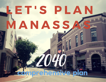
Using an 18-month process, the City of Manassas will update its Comprehensive Plan–the City’s key policy document for land use, development, preservation and related economic and social issues.  As part of that update, the City will also develop its first Transportation Master Plan to guide future transportation investments and improve mobility in the City.  This is an exciting time for City residents as the Manassas community envisions its future!

Citizen input in updating the Comprehensive Plan is vital to a more livable Manassas.  Throughout the summer and fall, the City will host a second round of Community Conversations on key topic areas, like land use and transportation.  These conversations began on June 19th with a visioning session on land use.  Additional meetings are scheduled throughout the summer and fall.  City Staff will also be available to meet with neighborhood and community organizations to gather feedback. Please contact 703-257-8223 for more information about hosting a meeting.

Upcoming Meetings

Parks & Recreation Community Conversation
hosted by the Parks & Recreation Committee
Wednesday, July 11th – 7 PM @ Manassas Museum, 9101 Prince William Street

Community Appearance & Environment Community Conversation
hosted by the Manassas Beautification Committee
Thursday, July 19th – 7 PM @ Public Works, 8500 Public Works Drive

Economic Development Community Conversation
hosted by the Manassas Business Council
Thursday, August 2nd – 12 PM @ Centerfuse, 9071 Center Street

Infrastructure Community Conversations
hosted by the Utility Commission
Thursday, August 9th – 7 PM @ Public Works, 8500 Public Works Drive

Culture & Historic Resources Community Conversation
hosted by the Historic Resources Board
Tuesday, September 4th – 7 PM @ Manassas Museum, 9101 Prince William Street

Community Conversation Town Hall
hosted by the Manassas City Council
Monday, September 17th – 7 PM @ Location TBA

Past Meetings

Comprehensive Plan Kickoff & Community Conversation on Land Use
hosted by the Planning Commission
Tuesday, June 19th– 7 PM @ Boys and Girls Club, 9501 Dean Park Ln.

Land Use Community Conversation Meeting Materials

Land Use Community Conversation Presentation

Additional Resources

About the Update

Current Comprehensive Plan

Community Conversations Phase 1

Sign Up for Updates

View coverage of the Community Conversations Kick Off meeting:

community conversations link

Please visit www.manassascity.org/planmanassas for additional information and additional meeting dates.

Regional Transportation Planning Board Seeks Public Input for Its Updated Plan

News Release: TPB seeks public participation in upcoming transportation forums

Apr 10, 2018

NCR-TPB’s Regional Activity Center Map

View interactive map of the seven transportation initiatives

The National Capital Region Transportation Planning Board (TPB) at the Metropolitan Washington Council of Governments (COG) is seeking public input for Visualize 2045, a new long-range transportation plan for the National Capital Region. The input will help elected leaders and regional planners better understand public attitudes and opinion as they make decisions about the region’s transportation future.

Visualize 2045 includes transportation projects for which funding is expected to be available between now and 2045, as well as those for which funding has not yet been identified.

A series of public forums have been scheduled to discuss seven unfunded initiatives recently endorsed by the TPB that have the potential to significantly improve transportation in the region. The TPB will gather feedback at the forums that will help decision makers better understand the universe of needs and potential projects and how they can affect the region’s transportation future.

These unfunded initiatives include: bring jobs and housing closer together; expand bus rapid transit regionwide; move more people on Metrorail; increase telecommuting and other options for commuting; expand express highway network; improve walk and bike access to transit; and complete the National Capital Trail.

The TPB will be holding nine forums in the following locations across the region:

Frederick County – Wednesday, April 11, 2018 | 7:00-9:00 P.M. | Thomas Johnson H.S.
Prince George’s County – Wednesday, April 18, 2018 | 7:00-9:00 P.M.  | College Park Airport
Charles County – Wednesday, April 25, 2018 | 7:00-9:00 P.M. | County Government Building
Montgomery County – Thursday, April 26, 2018 | 7:00-9:00 P.M. |Executive Office Building
Washington, D.C. – Tuesday, May 1, 2018 | 7:00-9:00 P.M. | COG
Arlington – Wednesday, May 2, 2018 | 6:30-8:30 P.M. | Arlington County Central Library Auditorium
Fairfax County – Tuesday, May 8, 2018 | 7:00-9:00 P.M. |Providence Community Center
Loudoun County – Wednesday, May 16, 2018 | 7:00-9:00 P.M. | Government Center
Prince William County – Wednesday, May 23, 2018 | 7:00-9:00 P.M. | PWC Government Center

MORE: Sign up for email updates, or to view forum details, visit visualize2045.org. Stay updated and join the conversation on Twitter using the hashtag #VIZ2045.

Contact: Laura Ambrosio
Phone: (202) 962-3278
Email: [email protected]

Transform I-66 Outside the Beltway Design Public Hearings, November 13, 14 & 16

Design Public Hearings
for Transform I-66 Outside the Beltway
November 13, 14 and 16, 2017

The Virginia Department of Transportation (VDOT), in partnership with I-66 Express Mobility Partners (EMP), will host Design Public Hearings on the Transform 66 Outside the Beltway Project regarding plans for the 22.5 mile corridor from I-495 to University Boulevard in Gainesville.

This will be our final opportunity to review and comment on the proposed design of the I-66 Trail, between Gallows Rd. in Dunn Loring and University Blvd. & Rte 29 in Gainesville.

Public Hearing Dates and Locations

All hearing times are from 6:00 p.m. until 8:30 p.m.
A formal presentation will begin at 7 p.m., followed by a public comment period.

Monday, November 13, 2017
for project segment 3 from Route 50 to I-495
Oakton High School Cafeteria 2900 Sutton Road, Vienna, VA 22181

Tuesday, November 14, 2017
for project segment 2 from Route 29 in Centreville to Route 50
Stone Middle School Cafeteria 5500 Sully Park Drive, Centreville, VA 20120

Thursday, November 16, 2017
for project segment 1 from Gainesville to Route 29 in Centreville
Piney Branch Elementary School Cafeteria/Gym 8301 Linton Hall Road, Bristow, VA 20136

Details:

  • View design plans and learn more about the proposed improvements
  • Discuss your questions with staff during the open house
  • Attend the formal presentation, followed by a public comment period
  • Provide oral and/or written comments
  • Comment period through November 29, 2017

City of Manassas Grant Avenue Streetscape Plan Meeting, November 9 @ 7 PM, Georgetown South Community Center

Meeting Address:

http://www.manassascity.org/grantave

Grant Avenue Streetscape Plan

  1. Grant Ave. Streetscape meeting
  2. Grant Ave. Streetscape meeting
  3. Grant Ave. Streetscape meeting
  4. Grant Ave. Streetscape meeting

Share your ideas and vision to help improve the appearance of Grant Avenue. Planning efforts will focus on improving Grant Avenue from Lee Avenue to Wellington Road.

Nov 9 meeting

Grant Ave_Presentation_062916 1
See the June 29 first meeting Presentation

View Meeting Exhibits with Public Comments:

    Existing Conditions

    Map My Walk Aerial

    Precedent Images

    Streetmix Sections

Want to keep informed about the Grant Avenue Streetscape Plan?
Sign up for emails or messages
 
Call 703-257-8232 for more information. 

Small Area Plans – Your Opportunity to Engage

As part of the ongoing Comprehensive Plan update, the Prince William County Planning Office has created several small area plans to guide development in key areas of the county. Each small area plan may offer opportunities for improved transit, increased open space, and greater walkability.

Public outreach will be accomplished through one or more public meetings and design charrettes for each project. A charrette is a collaborative planning session among a project’s various stakeholders – in this case, government officials, consultants and/or developers, and interested members of the public. A planning outline and some anticipated outcomes are provided for each active plan at the links below. There are no upcoming public hearings or charrettes currently scheduled, but the Planning Department promises to update the website when they have been. We will monitor the website as well.

Five plans that are currently active:

Dale City
The basis for this project is two studies completed earlier this year: one by the Dale City Sustainable Design Assessment Team (SDAT) and the other under a Metropolitan Washington Council of Governments (MWCOG) Transportation/Land-Use Connections (TLC) Program grant. The scope of the studies includes redevelopment of both the Dale Boulevard/Minnieville Road intersection and Mapledale Plaza at the intersection of Dale Boulevard and Queensdale Drive, as well as extensive redesign of vehicular, cycling, and walking infrastructure throughout the area.

Innovation Park
An examination of the Innovation Park area and a couple of miles of Prince William Parkway between Sudley Manor Drive and Godwin Drive/Nokesville Road, with the goal of developing Innovation Park as an economic center for PWC.

North Woodbridge
Covers US-1 between Occoquan River and Occoquan Road, north to I-95 and south to Belmont Bay Wildlife Refuge. The major issues appear to be the US-1/VA-123 interchange and multi-modal transportation options. There is currently very little usable infrastructure for non-motorized traffic in this area.

Small Area Plan: North Woodbridge

Parkway Employment Center
An update of the existing Parkway Employment Center sector plan at I-95/Horner Road/Prince William Parkway. A .pdf of the 2008 sector plan is available here.

Route 29
There is not a lot of information available for this plan yet. It will include a bike path along US-29 between US-15 and Somerset Crossing.

Future SAP projects include Independent Hill, Triangle, Yorkshire, and Fairgrounds/New Dominion.

Ryan Foster ([email protected]), Community Development Manager, and David McGettigan ([email protected]), Long-Range Planning Manager, are the primary points of contact for questions or comments.

Active Prince William is a group of concerned citizens who advocate for improving opportunities, support, and infrastructure for active transportation and healthy lifestyles within Prince William County, Manassas, and Manassas Park. We are interested in helping to make Prince William County and Greater Manassas a more livable and sustainable Community.

« Older posts Newer posts »